By Clara-Maria Casian, 25 April 2022
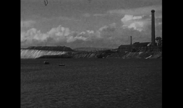
Feature image: Archive still of Ormsgill slag bank, c. 1960’s. Courtesy of Cumbria Archives.
People’s traces on land can be uncovered by understanding their historical past, from early agriculture to the mining of natural resources. Their inscription can be deciphered through the trail paths, the residues of an industrial and military past. The complexity of material and social changes in the British landscape is found in Barrow Islands, encapsulating stark contrasts where industries and natural histories collide. As deposits of rich hematite ore were found in 1850 around Roanhead, new ironworks and shipbuilding industries emerged, with diversification into shipbuilding and nuclear submarines. Mineral extraction industries extended to Askam, Millom, and Dalton. These complex relationships between the industry and the landscape created new ecosystems and complex life support systems. The former extractive landscape became the evidence of deindustrialization and natural asset stripping, with traces of past industrial activities, deep mining and production. The land carries layered histories with rich symbolism and conflicting narratives, still imprinted in the public perception.
As remnants of the ironworks and the town’s industrial past, slag banks represent an anchor of the town’s industrial past. However, since the closure of the ironworks, the formersites were perceived as blight, “Is it trying to erase its old industrial image? Indeed, and I think a lot of the scars have been removed […] Well, if you go there behind the ironworks, the slag bank has almost disappeared. The county council has done extensive work on removing that, while the other councils have looked at developing the environment even further and making opportunities for the industry.”

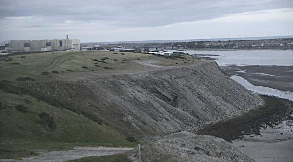
Ormsgill slag bank, Barrow-in-Furness, UK, 2019
In the Ormsgill area in Barrow-in-Furness, since the 1990s, an ongoing scheme has been reclaiming the derelict and contaminated land by laying soil on the bank. Visitors use the slag heap recreationally as vantage points to look upon their coastal landscape, Walney channel and Black Combe. In one interview with a local naturalist, it is revealed that the removal of the slag heap causes environmental risks: “The wish was to take the slag bank right down to the bottom to get back to the original shoreline, but it was full of toxic material. It’s something that probably took natural habitats away. But it’s become a natural habitat in its own right.”
Therefore, the former mine sites have become natural habitats, with thriving species of fauna and flora, as the residue from the hematite ore smelting produces favourable conditions for plants to release nutrients.

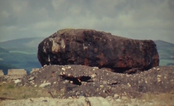
Remnant from steel industry. Archive still from Millom, Homeground series, BBC North West, 1980, 17 min, 650 ft., colour. Courtesy of North West Film Archive
According to the RSA index 2016, Barrow was placed first in the category “Assets of Landscape and Natural Heritage” across England. It was also ranked 162nd for how people use this landscape, revealing how unemployment and a fractured sense of place change one’s relationship with the landscape. Unaddressed acts of slow violence caused by political and economic unrest affect communities as segregation and resentment seep in. Slag heaps, manufactured monuments call for a renewed focus on the role of ruin, involving derelict spaces not part of the “protected areas” and natural reserves classifications. These places are caught in the before and after, as their history is erased, and their identity is rearticulated for further repurposing or exploitation of mineral resources. A renewed engagement with ruined sites can become an opportunity for a slow recovery process. Through an embodied human-centred approach, their reconfiguration from inconvenient debris can inform the impact of industrial closures by reflecting on the ruination of coastal places and their lasting effects on living ecosystems and working-class communities.


 Canada. Dept. of Mines and Resources / Library and Archives Canada / PA-021558